

Last updated: October 2026
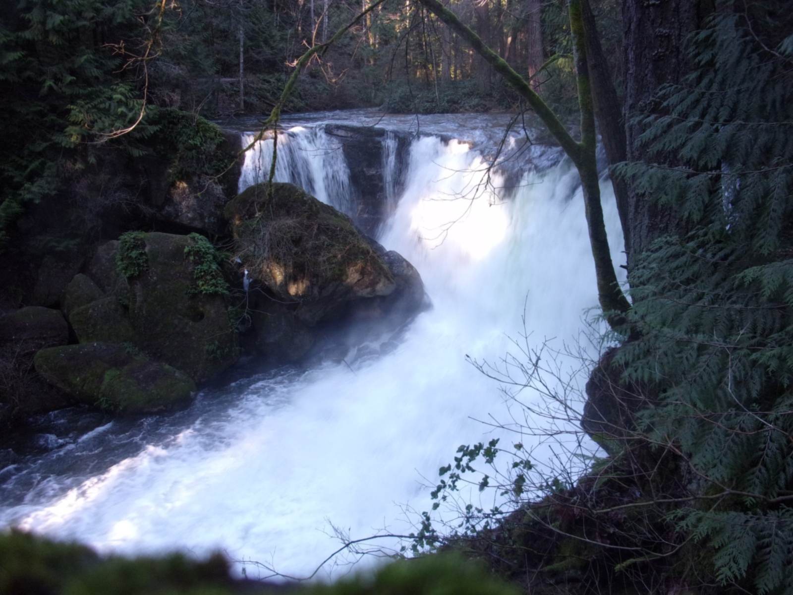
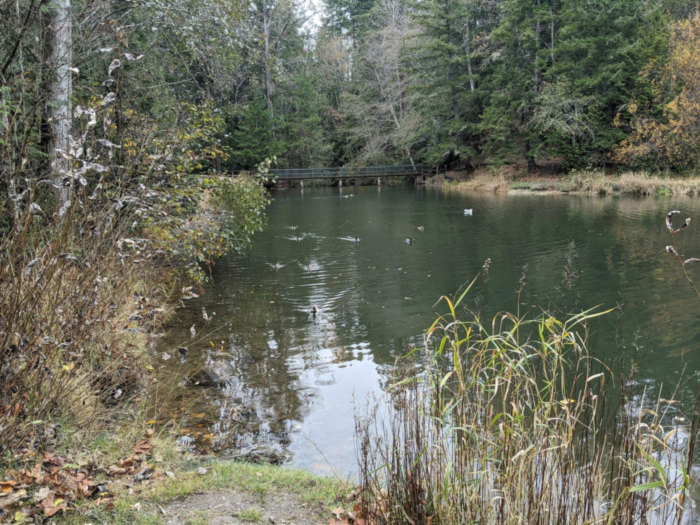
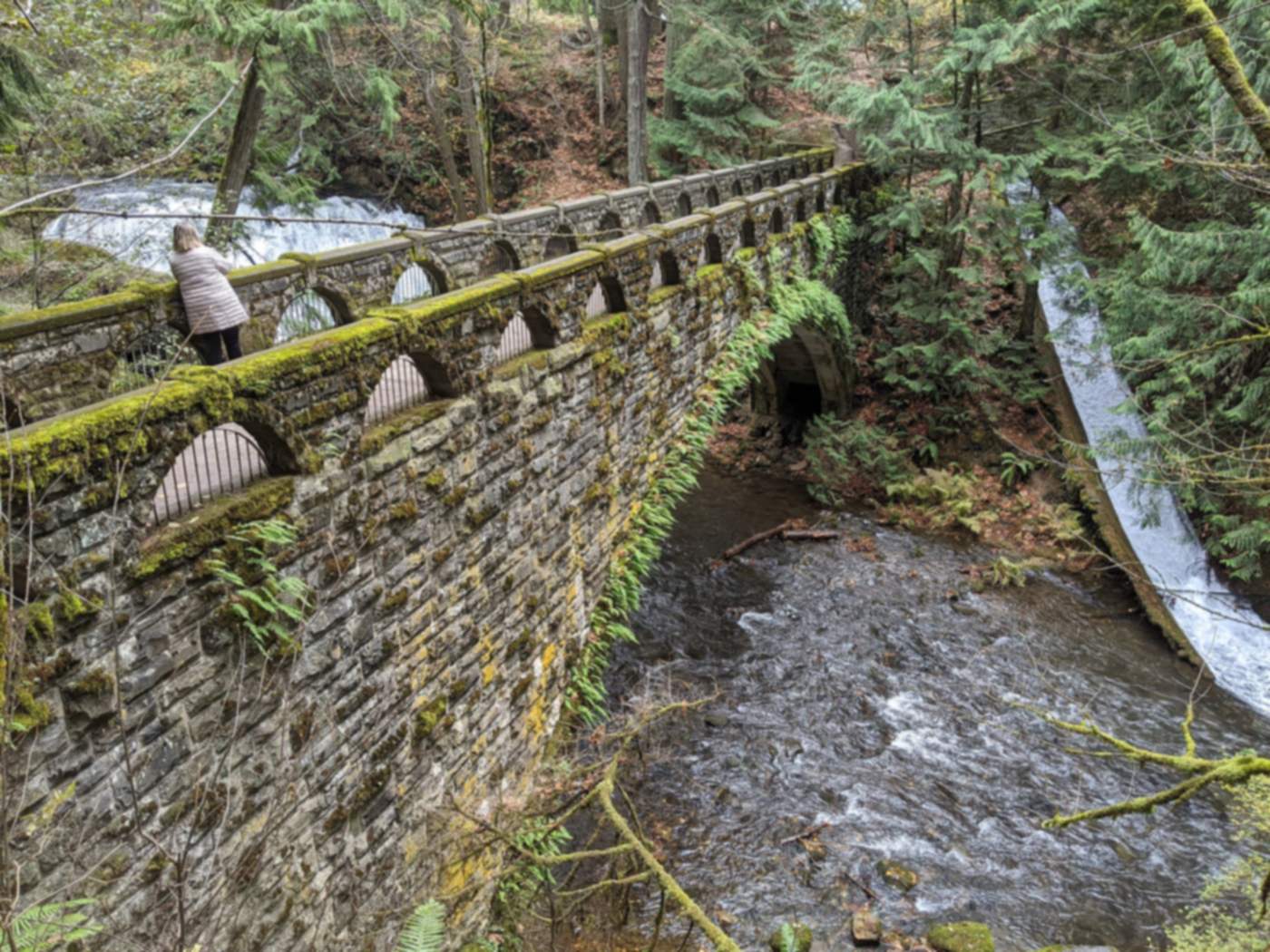
On a Saturday morning in the Whatcom Falls neighborhood of Bellingham, people line the 1939 stone bridge to watch Whatcom Creek pour over the falls, while kids with fishing poles crowd the Derby Pond below the fish hatchery.1,2 A few minutes away, south of Lakeway Drive, the streets turn quiet and residential.3
Whatcom Falls sits at the eastern edge of the city, south of Whatcom Creek, and is home to more than 2,000 Bellingham residents.3 Unlike nearby Geneva, it is inside Bellingham city limits. If you want a big forest park as your backyard and a short drive to the rest of town, it belongs on your list.
Thinking about a home near the falls? Contact our team to start your Whatcom Falls search.
On this page:
- What is it like to live in Whatcom Falls?
- Where is Whatcom Falls, and how do residents get around?
- What does Whatcom Falls Park offer?
- What kinds of homes are in Whatcom Falls?
- What should buyers know before buying in Whatcom Falls?
- Frequently asked questions about Whatcom Falls
- Which neighborhoods are near Whatcom Falls?
- Sources
What is it like to live in Whatcom Falls?

Life here splits neatly along Lakeway Drive. The city describes the neighborhood as bisected by Lakeway, with Bayview Cemetery and Whatcom Falls Park on one side and the residential streets on the other, south of Lakeway.3 So the park and cemetery give the north side a green, open feel, while most homes sit on the south side.
A good share of the land is public. Bayview Cemetery, Whatcom Falls Park and the Kulshan Middle School site make up the publicly owned part of the neighborhood.3 Kulshan Middle sits right in the neighborhood at 1250 Kenoyer Drive.3,4
The outdoors goes beyond the park, too. The city and county worked together to preserve 60 acres at the end of Birch Street for future park and trailhead use, known as Lookout Mountain.3 The city's GIS also shows the Galbraith Mountain Open Space inside the neighborhood, and the park trail map marks Birch Street as the way toward Galbraith Mountain.5,6 Bloedel Donovan Park on Lake Whatcom is easy to reach as well.3
Where is Whatcom Falls, and how do residents get around?
On the city's neighborhood map, Whatcom Falls covers about 962 acres. It borders Alabama Hill to the north, Silver Beach to the northeast, Roosevelt to the northwest and Puget to the west.5 East of the city line is Geneva, in unincorporated Whatcom County.
In city address records, the streets with the most addresses include Alvarado Drive, Kenoyer Drive, Raymond Street, Newton Street, Lakeway Drive, Brookstone Drive, Roland Street, Yew Street and Birch Falls Drive. Electric Avenue, Silver Beach Road and Old Lakeway Drive also run through it.5
Lakeway Drive is the main road. The city's park brochure gives directions from I-5 at Exit 253, heading east on Lakeway.2 Most errands mean a drive west on Lakeway toward the rest of town.
For walking and biking, the Whatcom Creek Trail runs through the park. The city's trail guide puts the stretch from the stone bridge to the Railroad Trail at 0.4 miles, and from the Railroad Trail to Bloedel Donovan Park at 0.2 miles.6
What does Whatcom Falls Park offer?

Whatcom Falls Park is the landmark here. The city lists its address as 1401 Electric Avenue, in the Whatcom Falls neighborhood, and it is open 6 a.m. to 10 p.m. daily.1 The city's park brochure puts it at 241 acres.2
There are two entrances. Use 1401 Electric Avenue for the sports field and upper playground. Use the Silver Beach Road entrance off Lakeway Drive for the picnic shelters, fish hatchery, lower playground, creek bridge and Derby Pond.1
- The falls and stone bridge. The bridge was built in 1939 from Chuckanut sandstone that Works Progress Administration crews moved from a burned downtown building. The city calls it an excellent spot to view the waterfall.2,6
- Fish hatchery and Derby Pond. The hatchery was built in 1936. The pond is stocked by the hatchery, and seasonal fishing there is only for kids 14 and under.2
- Trails. About 5.5 miles of mostly rolling gravel trails, with some steep grades.2
- Dog off-leash area. Dogs can be off leash on the trails across the bridge, north of the creek. Everywhere else, leashes are required.1,2
- The basics. Two reservable picnic shelters, playgrounds, a multipurpose field, a basketball court, tennis courts, barbecue grills, restrooms and parking.1
The park has deep roots. The Young Men's Commercial Club raised money to buy the first 40 acres in 1908.2 It also carries a hard memory: on June 10, 1999, a buried pipeline burst and spilled more than 200,000 gallons of gasoline into Hannah and Whatcom Creeks. The fire burned 1.5 miles of creek habitat and three young people died. An observation area with interpretive displays tells that story and the recovery since.2
What kinds of homes are in Whatcom Falls?
Whatcom Falls is mostly residential. The city says most development here is built at about four homes per acre, which points to single-family houses on regular lots rather than dense apartment blocks.3
The city also notes that large tracts of undeveloped land remain in the southern and eastern parts of the neighborhood.3 That can mean new construction nearby over time, so check zoning on any land near a home you like. The city posts a zoning map and zoning table for Whatcom Falls on its neighborhood page.3
What should buyers know before buying in Whatcom Falls?
Trade-offs and who it suits
Busy park days. Whatcom Falls Park draws people from all over town. On sunny weekends, expect full lots at the park entrances and more cars on nearby streets.
Lakeway Drive. It is the main route to I-5 and the rest of the city, so homes close to it hear more traffic.
Car-first for errands. The neighborhood is mostly homes, park and cemetery, so most shopping means driving.3
Future building. Undeveloped land in the south and east could see new homes someday.3
School changes. Part of the neighborhood is in an elementary zone the district plans to close. More below.
Who it suits: people who want trails, a waterfall and a dog-friendly park within walking distance, inside city limits, and who are fine driving for errands.
Market snapshot and homes for sale
We could not find a published Whatcom Falls median price from two independent sources, so here are citywide numbers (houses and condos combined):7,8
- Bellingham median sale price, July through September 2026: about $675,000 (Redfin)
- Bellingham median sold price, October 2026: $662,500 (Realtor.com)
- Whatcom Falls median price: not published
Homes near the park and newer houses on the south side can price differently from the city median, so ask us for recent Whatcom Falls sales by home type. You can also try our home affordability calculator to see what range fits.
Schools
Whatcom Falls is in Bellingham Public Schools. On the city's school attendance layers, about 65% of the neighborhood's land is in the Carl Cozier Elementary zone (1330 Lincoln Street), about 31% is in the Wade King Elementary zone (2155 Yew Street Road), and a small edge is in the Roosevelt zone. All of it feeds Kulshan Middle (1250 Kenoyer Drive). About 96% feeds Sehome High (2700 Bill McDonald Parkway), with a sliver in the Bellingham High zone.4,5,9,10,11
That elementary picture may change. On September 29, 2026, the district announced plans to close Carl Cozier after this school year, pending school board approval, with its students attending Sunnyland and Wade King elementary schools starting August 2027.12 Public hearings are set for November 2 and 3, and the board is expected to vote at its November 12 meeting.13 If you are buying with kids, confirm any address with the district's boundary lookup.14
Frequently asked questions about Whatcom Falls
Is Whatcom Falls inside Bellingham city limits?
Yes. It is a City of Bellingham neighborhood at the eastern edge of the city. Geneva, just to the east, is the area outside city limits.
Where is Whatcom Falls Park, and when is it open?
The main address is 1401 Electric Avenue. A second entrance on Silver Beach Road off Lakeway Drive leads to the picnic shelters, fish hatchery and Derby Pond. The park is open 6 a.m. to 10 p.m. daily.
Can I take my dog to Whatcom Falls Park?
Yes. Dogs can be off leash on the trails across the bridge, north of the creek. Everywhere else, keep them leashed.
Which schools serve Whatcom Falls?
Most of the neighborhood is in the Carl Cozier or Wade King elementary zones, all of it feeds Kulshan Middle, and nearly all feeds Sehome High. The district plans to close Carl Cozier after this school year, pending a board vote expected November 12, 2026.
What kinds of homes are in Whatcom Falls?
Mostly single-family homes. The city says development is typically about four homes per acre, and some undeveloped land remains in the south and east.
How much do homes cost in Whatcom Falls?
No reliable Whatcom Falls median is published. Citywide, Redfin put Bellingham's median sale price at about $675,000 for July through September 2026, and Realtor.com put the October 2026 median sold price at $662,500.
Which neighborhoods are near Whatcom Falls?
Whatcom Falls borders Alabama Hill to the north, Silver Beach to the northeast, Roosevelt to the northwest and Puget to the west. Just outside the city to the east is Geneva. You can also browse all our Bellingham neighborhood guides.
Ready to look near the falls? Bellingham Real Estate Agents can line up showings.
Back to all Bellingham neighborhoods
Sources
- Whatcom Falls Park at 1401 Electric Avenue in the Whatcom Falls Neighborhood; two entrances (Electric Ave for sports field and upper playground; Silver Beach Road off Lakeway Drive for picnic shelters, fish hatchery, lower playground, creek bridge, Derby Pond); hours 6 a.m. to 10 p.m.; amenities incl. dog off-leash area, two reservable picnic shelters, tennis, basketball, restrooms, parking. City of Bellingham: Whatcom Falls Park. Checked Oct 31, 2026.
- Park history and facts: first 40 acres bought 1908 by Young Men's Commercial Club; current 241 acres; hatchery built 1936; WPA moved Chuckanut sandstone, stone bridge built 1939; June 10, 1999 pipeline fire (over 200,000 gallons, 1.5 miles burned, three lives lost); observation area; Derby Pond youth 14 and under; 5.5 miles of trails; off-leash north of creek; directions from I-5 Exit 253 east on Lakeway. City of Bellingham: Whatcom Falls Park brochure (PDF). Checked Oct 31, 2026.
- Eastern edge of the city south of Whatcom Creek; over 2,000 residents; bisected by Lakeway Drive; mostly residential at about four units per acre; large undeveloped tracts in south and east; Bayview Cemetery, Whatcom Falls Park and Kulshan Middle School site are public land; Bloedel Donovan easily accessed; 60 acres preserved at end of Birch Street (Lookout Mountain); zoning map and table. City of Bellingham: Whatcom Falls Neighborhood. Checked Oct 31, 2026.
- Kulshan Middle School, 1250 Kenoyer Drive. Kulshan Middle School. Checked Oct 31, 2026.
- Neighborhood polygon (layer 4, about 962 acres) and adjacency; address points by street (layer 3); elementary, middle and high attendance shares by land area (layers 11 to 13, rounded: Carl Cozier 64.9%, Wade King 31.3%, Roosevelt 3.4%, Silver Beach 0.5%; Kulshan 100%; Sehome 96.1%, Bellingham 3.9%); parks layer 18 (Galbraith Mountain Open Space inside neighborhood). My own spatial analysis. City of Bellingham GIS: report layers. Checked Oct 31, 2026.
- Whatcom Creek Trail mileage (Stone Bridge to Railroad Trail 0.4 mi; Railroad Trail to Bloedel Donovan 0.2 mi); Birch St. to Galbraith Mtn.; stone bridge an excellent waterfall viewing spot. City of Bellingham: Whatcom Falls Park trail map (PDF). Checked Oct 31, 2026.
- Bellingham median sale price $675K over the last 3 months (ending September 2026), all home types. Redfin: Bellingham housing market. Checked Oct 31, 2026.
- Second source: Bellingham median sold price $662,500, key indicators as of October 2026. Realtor.com: Bellingham housing market. Checked Oct 31, 2026.
- Carl Cozier Elementary, 1330 Lincoln Street. Carl Cozier Elementary School. Checked Oct 31, 2026.
- Wade King Elementary, 2155 Yew Street Road. Wade King Elementary School. Checked Oct 31, 2026.
- Sehome High School, 2700 Bill McDonald Parkway. Sehome High School. Checked Oct 31, 2026.
- Sept 29, 2026 plan to close Carl Cozier and Columbia after this school year, pending board approval; Cozier students to Sunnyland and Wade King from August 2027. Bellingham Public Schools: facilities update. Checked Oct 31, 2026.
- Public hearings Nov 2 and 3; vote likely at Nov 12, 2026 meeting. Cascadia Daily News, Oct 15, 2026. Checked Oct 31, 2026.
- School list and boundary lookup. Bellingham Public Schools: schools and boundaries. Checked Oct 31, 2026.